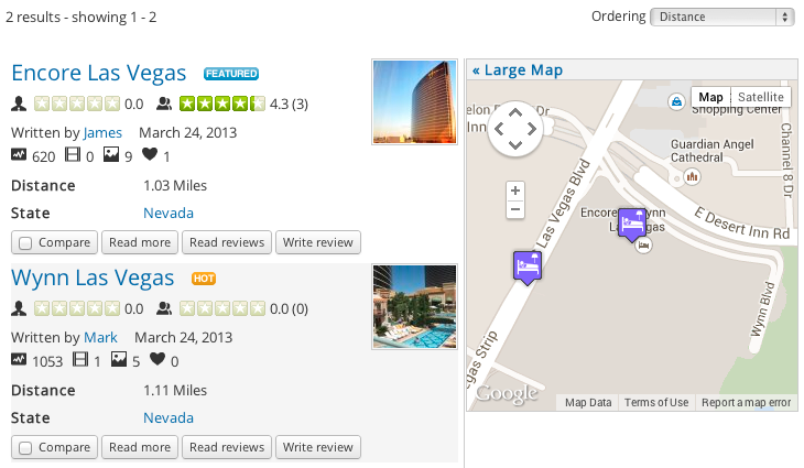
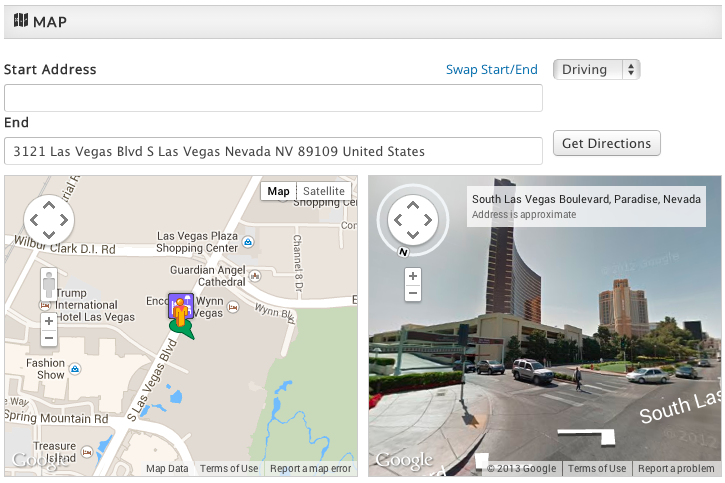
GeoMaps Add-on Overview
GeoMaps delivers an amazing implementation of the Google Maps experience right on your website so you can keep your visitors on your site. We've made it dead simple to add the location of a listing on a map with the click of a 'map it' button and you can drag the marker to fine tune its location. You can also assign different marker icons per category and enable 'get directions' and 'streetview'. Combined with the file upload capability in JReviews, it's easy to add a KML layer to each listing by uploading KML files attachments. If you already have a large database of listings with addresses, GeoMaps can batch geocode them to add the coordinates for you.
The GeoMaps add-on incorporates two distinct and powerful functionalities into JReviews: Proximity search and Mapping.
Proximity search
This functionality enables your site's users to use a partial or full address to find nearby locations stored in the JReviews database and sorted by distance. Users can perform address search, zipcode and postal code searches. The add-on takes advantage of the JReviews Advanced Search module for complex custom searches that can use both the address and custom fields. GeoMaps comes with bulk Geocoding functionality that easily converts listings’ physical addresses to coordinates, processing thousands of listings in a short time. It also enables your site's users to geocode an address when submitting new listings and even fine-tune the location by dragging the marker on the map.
Mapping
Once a listing's address has been geocoded it's possible to show its location on a map. The GeoMaps addon allows you to display a map with markers for your listings in category pages, search results and detail view. A GeoMaps module is also included to display marker locations on a map. The addon has a lot of customization features for the map so you can have different markers for different types of businesses and toggle many of the features available with the Google Maps API including Street Views and walking and driving Directions.
Google has introduced usage limits for the display of maps taking place in early 2012. You get 25,000 free map loads per day. You can create a Google API Console account to start tracking your API usage. More information can be found here: https://developers.google.com/maps/faq#usagelimits.
A note on geocoding
Geocoding is the process of converting a physical address to its coordinate equivalent (latitude/longitude). To perform this task GeoMaps uses the Google Maps API geocoding service, which has a limit of 2,500 free geocoding transactions per day per IP Address. More information here: http://code.google.com/apis/maps/documentation/geocoding/#Limits.
Geocoding calls to the API are made during bulk geocoding, use of the add-on’s Map It feature and also whenever an address search is performed because the address needs to be converted to coordinates first in order to find nearby points.


