Difference between revisions of "GeoMaps Module"
(Created page with " The GeoMaps module is automatically installed with the add-on and allows you to show all the locations of a directory, section or category. It has category autodetect functional...") |
(No difference)
|
Latest revision as of 13:22, 15 December 2013
The GeoMaps module is automatically installed with the add-on and allows you to show all the locations of a directory, section or category. It has category autodetect functionality so a single module instance can be used on multiple pages showing different markers.
Important: the module is not capable of showing all markers for an address search. Instead the list map must be used.
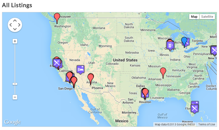
Example of a GeoMaps module:
The GeoMaps module has many parameters:
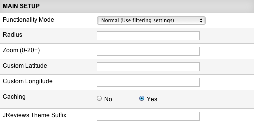
Functionality Mode - available options:
- Normal (Use filtering settings) - the map will display listings based on the Basic/Advanced filters that you specify.
- Geo Targeting (IP Address to Location) - with this mode, the map will be automatically centered to the site's visitor location calculated based on the visitor's IP address. This option requires that you enter Radius and Zoom values.
- Custom center & zoom - enter Custom Latitude and Custom Longitude to which the map will center. Radius and Zoom values are required with this mode as well.
Caching - with lots of markers this setting is very important to cache the json object that the map uses to load the markers.
JReviews Theme Suffix - if you need multiple copies of the GeoMaps module and you want each one to use a different theme file, you can specify a theme suffix here.
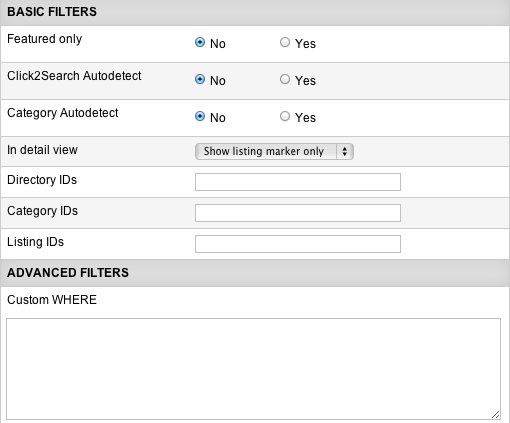
Featured Only - if enabled, the map will display only featured listings.
Click2Search Autodetect - automatically filters results when in Click2Search pages using the value from the click2search field.
Category Autodetect - filters results to the current category.
In detail view - allows you to change the behavior of the map when the module is shown in listing detail pages.
Directory/Category/Listing IDs - filter the markers shown using these settings. It’s not necessary to fill in all of them, just one.
Custom WHERE - filter the markers shown based on custom database query. For more info read Using Custom WHERE and Custom ORDER BY parameters.
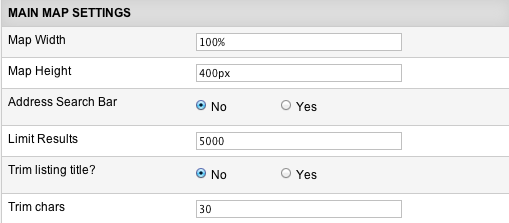
Map Width - remember to include px or %. For example 100% or 500px.
Map Height - enter the height in px.
Address Search Bar - allows users to quickly find a location on the map. Uses the Google geocoder which has a free 15k per day transation limit. This feature is not fully compatible with Geo Targeting with a radius is set because not all markers are available on the map. If a user types an address outside the radius search no markers will be shown.
Limit Results - set a limit to the number of markers shown on a map. This is important for performance gains if you have too many results and all markers should not be shown on the map.
Enable clustering - groups markers at high zoom levels. Must be used when showing a large number of markers for performance gains.
Clustering Min Markers - when clustering is enabled, any number of markers above this setting will trigger the marker clustering functionality.
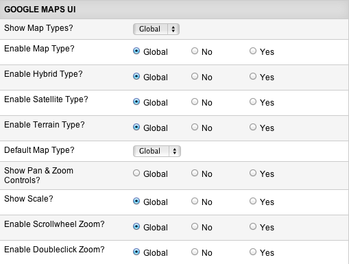
You can turn on and off all of the standard Google Map controls using these parameters.
